In the Nitsitapi creation story, Na'pi, or Old
Man, in service to the Creator, marks off the ground that would be their
home.
|
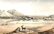
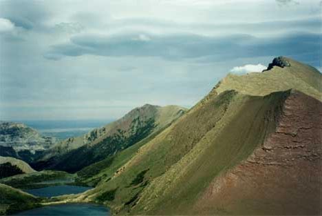
From peaks to plains, a view from
Waterton Park
|
S. Thompson photo
|
| |
|
Blackfeet Creation Story, and the First Buffalo
A version prepared
by Jim Kipp
"In the begining all the world was water. One day
Old Man, either by design or because he was just curious, decided to find
out what might lie beneath the water. He sent animals to dive below the surface...
At last muskrat rose slowly to the surface, holding between his paws a little
ball of mud. Old Man took this small lump of mud and blew upon it. The mud
began to swell. It continued to grow larger until it became the whole earth.
"Then Napi traveled
about the earth piling up rocks to make mountains, gouging out beds of rivers
and lakes and filling them with water. He covered the plains with grass...He
made the animals and the birds. And then, from a lump of clay, he made himself
a wife.
"Together
Old Man and Old Woman designed the people and determined how they should live....
"The boundaries
of this land are given as running east from a point in the summit of the Rocky
Mountains west of Fort Edmonton, taking in the country to the east and south,
including the Porcupine Hills, Cypress Mountains, and Little Rocky Mountains,
down to the mouth of the Yellowstone on the Missouri ; then west to the head
of the Yellowstone, and across the Rocky Mountains to the Beaverhead ; thence
to the summit of the Rocky Mountains and north along them to the starting-point.
"When Napi got
to the north point of the Porcupine Mountains, his people asked him what they
were to eat? Napi made many images in the form of buffalo. Then he blew
breath on these, and they stood up ; and when he made signs to them, they started
to run. Then he said to his people, 'those are your food'. They said to him ," how
are we to kill them?" " I will show you," he said. He took them
to the cliff, and told the people to run the buffalo over it, and take the flesh
to eat. They tried to tear the limbs apart and take bites of the flesh, but they
could not. So Old Man went to the edge of the cliff, and broke some pieces of
stone with sharp edges, and told them to cut the flesh with these. When then
they had taken the skins from these animals, they set up poles and put the hides
on them, and so made a shelter to sleep under. Their legs broken, but they were
still alive. The people cut strips of green hide, and tied stones in the middle,
and made large mauls, and broke in the skulls of the buffalo, and killed them."
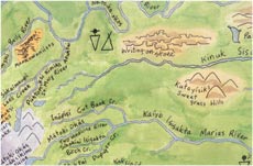
Percy Bullchild Map
| Percy Bullchild’s map illustrates Blackfeet aboriginal hunting
area. Napi stories told in his book, The Sun Came Down, are included
on this map with a key for the numbered places. |
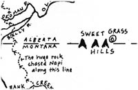 From The Sun Came Down
Percy Bullchild, 1985 |
|